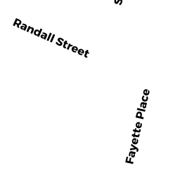
19R RANDALL STREET
Owner Information
ROSA MICHAEL & LORRAINE
1865 WILLIAMS STREET
DIGHTON, MA 02715


Property Details
19R RANDALL STREET is classified as a Two-Family Residential (Two family).
The primary structure on this property was built in 1932. There are 3,157ft2 of built area within this property. There is 1,976ft2 of residential/living space within this property. This property is listed as having 10 rooms.
19R RANDALL STREET is valued at $235,000. The land is valued at $54,700 and the structures are valued at $176,900. There is an additional valuation of $3,400 on this property.
This property is in Zone 3.46. Confirm with local Zoning Board authorities to ensure there are no overlays or other easements on this property.
The most recent deed for 19R RANDALL STREET is recorded at the local registrar in Book 19881, Page 0251. 19R RANDALL STREET was last sold on Friday, January 13, 2012 for $100.
Assessment data from fiscal year 2021.
Flood Data
According to the FEMA National Flood Hazard Layer, this property does not appear to be in a flood zone. It may also be in an area not yet reviewed. Nonetheless, confirm this information prior to taking any action.
To view the flood hazards around this property, create a FEMA "Firmette" Map of the area around 19R RANDALL STREET.
Broadband Internet Providers
| Provider | Type | Bandwidth (mbps) | |
|---|---|---|---|
| PAETEC Communications, Inc | DSL | 0 | 0 |
| Comcast | Cable | 1000 | 35 |
| GCI Communication Corp. | Satellite | 0 | 0 |
| HughesNet | Satellite | 25 | 3 |
| Verizon New England Inc. | Fiber | 940 | 880 |
| VSAT Systems, LLC. | Satellite | 2 | 1 |
| Verizon New England Inc. | DSL | 15 | 1 |
| Viasat Inc | Satellite | 100 | 3 |
| Crown Castle Fiber | Fiber | 0 | 0 |
| T-Mobile | Fixed Wireless | 25 | 3 |
Broadband service provider data from December 2020.
Adjacent Properties
- 19 RANDALL STREET
Three-Family Residential owned by TRAVIS LENA TR TRAVIS FAMILY TR - 23R RANDALL STREET
Single Family Residential owned by FREITAS PAUL NORBERT - 14 DEAN AVENUE
Two-Family Residential owned by SOUSA JOSE H & ZELIA M - 15 RANDALL STREET
Single Family Residential owned by TRAVIS LENA TR TRAVIS FAMILY TR